Mixed Reality outdoor educational tool
The application “Mixed Reality tool” on tablet and smartphone consists
of an AR / MR educational tool allowing real-time interaction between a
group of children/students/adults and the teacher/guide.
The classes can take place in an open field in the area of former mining
excavations (underground or surface). The beginning of the workshops
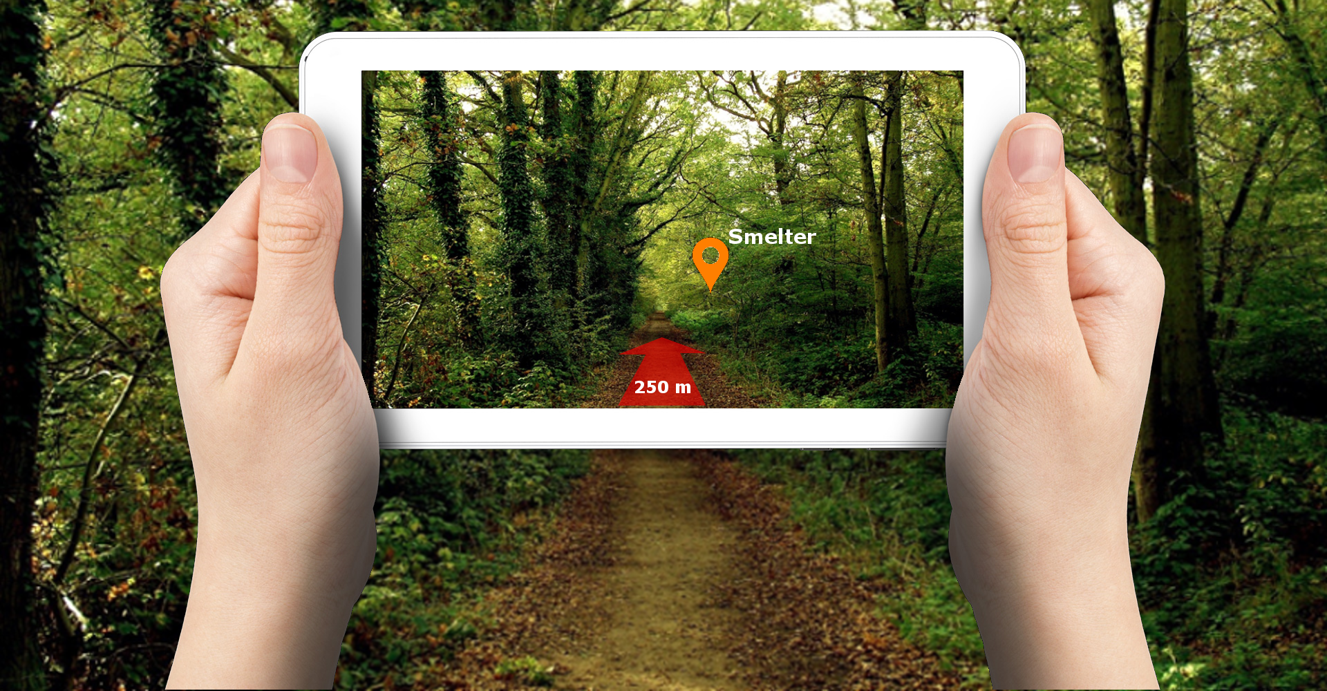
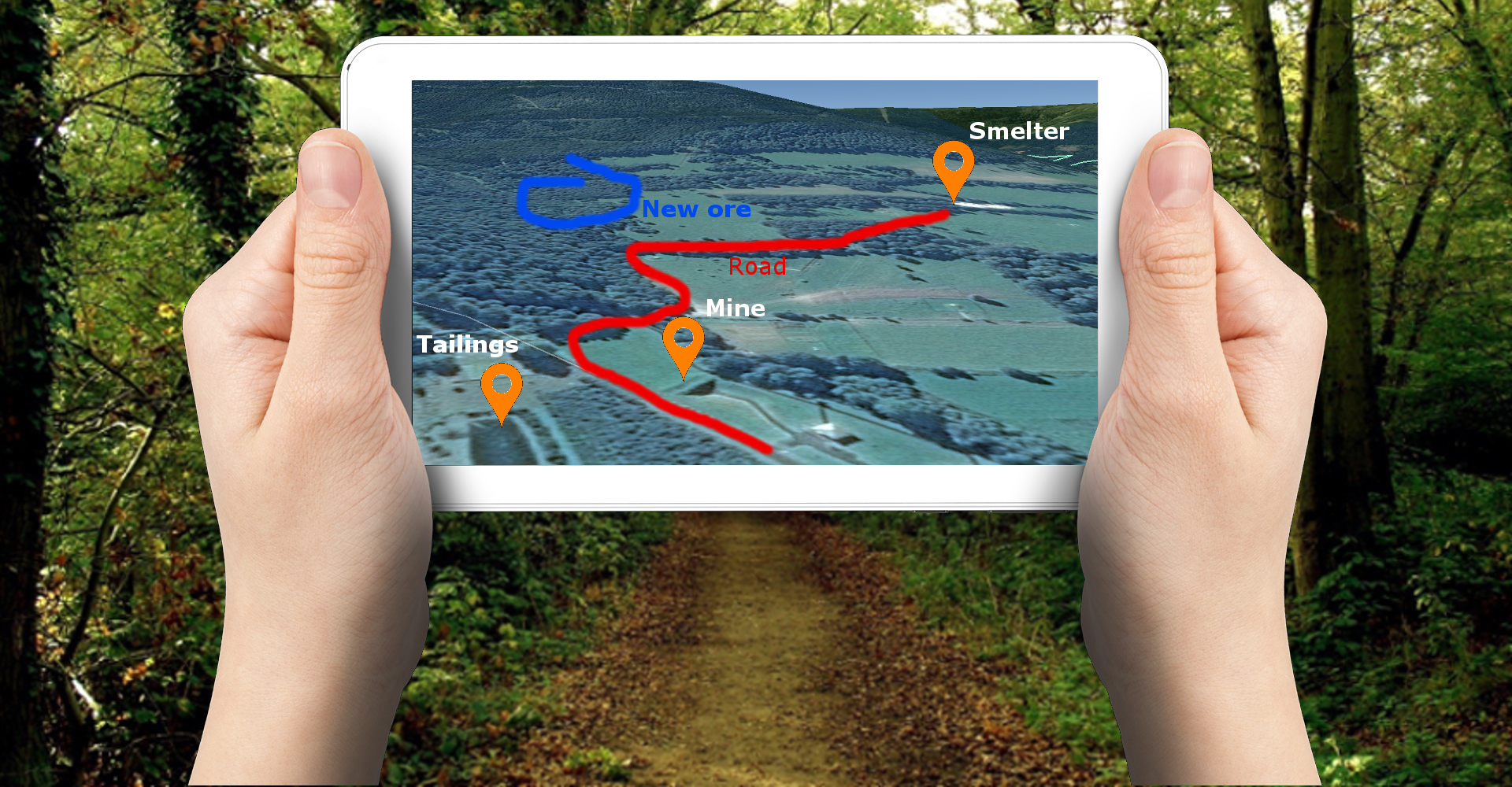
starts by showing a map marker to the device camera. As a result, an
interactive map is shown with points of interest (POIs) marking places
of processing, storage of ore, tailings collection, etc. Each of them is
possible to click to start the navigation to that location. In addition,
the teacher has the opportunity to draw a navigation path or mark other
interesting places on this map. After discussing the region of former
exploitation, a field game can be started, consisting of finding further
remains of the former mining.
The Mixed Reality outdoor educational tool allows real-time interaction
between a group of students (children, adults, tourists..) and the
teacher - guide. Students or visitors interact with the trainer
(teacher, guide, employee) in real time. The flexibility of the 3D
application is based on the possibility of using it in any historical
mining area (mining heritage areas, abandoned quarries, geotourist
routes) in every European Country. The basic assumption is to give the
possibility to adapt educational context related to a given area.
Technical assumptions and contents of substantive content including 3D
models and processes visualizations (animations) were developed for 2
pilot areas:
- Marcelo Jorissen Mine in Madrid, Spain
- Tourist Route “By the traces of the former ore mining” in the Mirsk
Commune, Poland
Education tool basing of Mixed Reality can have wide application in
mining education in a wide spectrum of thematic issues (subjects for old
and present mining operations) and location (classes in open pit and
underground mines or mining heritage areas). The classes can take place
in the field and information can be distributed through the application
(possibility of drawing on the tablet/smartphone screen e.g. paths of
rock transportation). After the classes, there is the plan to organize
the outdoor game for participates. Thanks to the flexibility of the
developed tool, its availability (downloading the application on the
smartphone or tablet) and the possibilities of its wide use for various
types and origins of modelled mining and post-mining objects, and thus -
for a variety of educational activities, the scale of the VirtualMine
project results was significantly increased.
You can find the guide (tutorial) for the user of ‘Mixed Reality Tool’
application here:
Guide
Functionality:
1. Possibility to use in various places around the world by:
- adding your own models in * .fbx format
- defining the insertion point of the models by specifying their
geographical coordinates
- adding individual descriptions / information to these models,
currently, three languages are implemented (English, Spanish, Polish),
but the application can be expanded
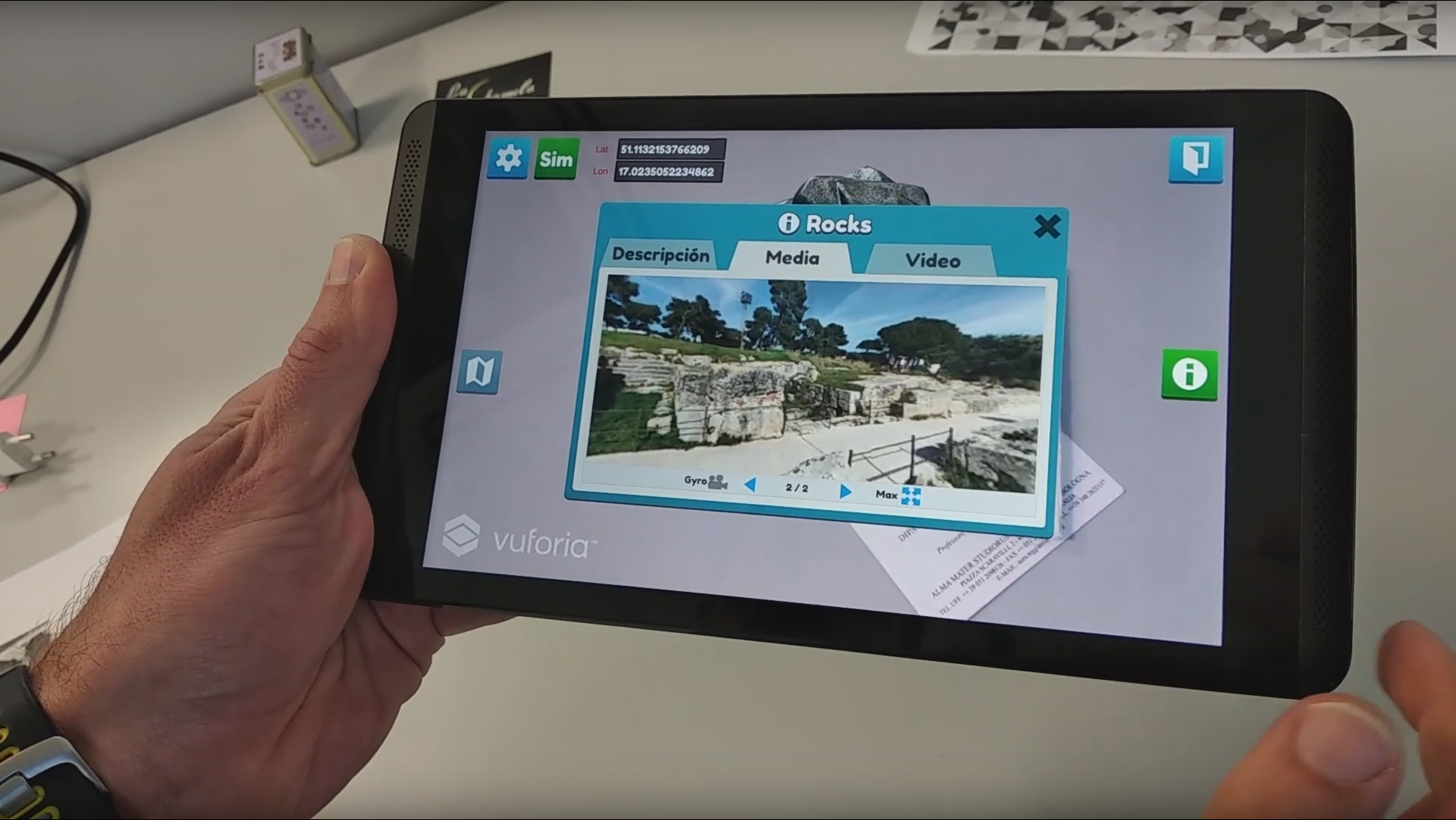
- linking multimedia content to objects (pictures, 360-degree photos,
videos).
2. Navigation to individual points using the GPS receiver embedded in
the device or along the path traced on the map.
3. The application may use different servers with models and data, so
the content can be protected from unauthorized access.
4. Possibility to use "graphic markers" for the presentation of content
(models, descriptions and media), in addition to location markers (GPS
coordinates).